Dad Why Do the Trees Change Colors?
Every year I reluctantly hang on to summer and resist the coming of Fall. Despite my best efforts the days keep getting noticeably shorter, the nights have a chill, and heck it is mid-September and just snowed in the Sierra! So, I will throw in the towel and look forward to Halloween and Fall colors. Hopefully, this post will give you a bit of trivia and a lot of information on how to successfully see Fall colors in the Sierra.
Bishop Canyon
- March 2026
- October 2024
- May 2023
- December 2022
- July 2022
- June 2022
- May 2022
- January 2022
- December 2021
- November 2021
- October 2021
- July 2021
- June 2021
- May 2021
- January 2020
- July 2019
- June 2019
- May 2019
- April 2019
- March 2019
- February 2019
- January 2019
- September 2017
- August 2017
- July 2017
- June 2017
- January 2017
- December 2016
- November 2016
- October 2016
- September 2016
- January 2016
- November 2015
- July 2015
- May 2015
Every year I reluctantly hang on to summer and desperately resist the coming of Fall. Despite my best efforts the days keep getting shorter, the nights have a chill, and heck it is mid-September and it just snowed in the Sierra! So, I will throw in the towel and look forward to Halloween and Fall Colors. Hopefully, this post will give you a bit of trivia to impress your friends and a lot of information on how to successfully see the Fall colors in the Sierra.
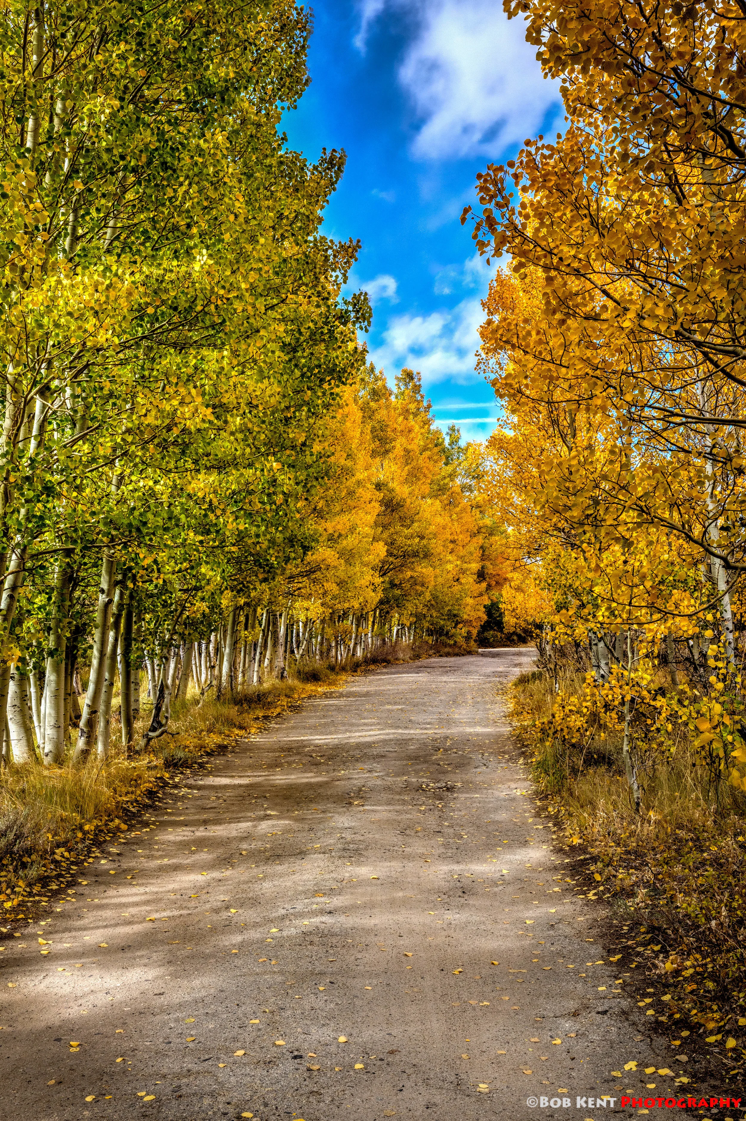
Bishop Canyon
Why do leaves change color?
The short answer is simply the leaves get less light. There is more to it than that! Here is your trivia facts that you can use to impress your fellow Fall Color lovers.
Trivia Fact 1. In fall the days grow shorter. The reduction in the total amount of light the tree leaves receive induces a chemical change causing a corky wall to form between the twig stem and the main portion of the leaf.
After a while this corky wall causes the leaf to drop off the tree. Before it falls however, the wall blocks the in and exit vessels which traps sugars in the leaves. With reduced light an no new food the green chlorophyll pigments die. This allows us to see the two other pigments the leaves always have had - carotene (yellow) and anthocyanin (red).
Trivia Fact 2. The reason the leaves look more vibrant after sunny days is that the sunlight continues to produce anthocyanins after the blockage occurs. During cloudy days less anthocanin is created and the leaves take on a more pastel tones.
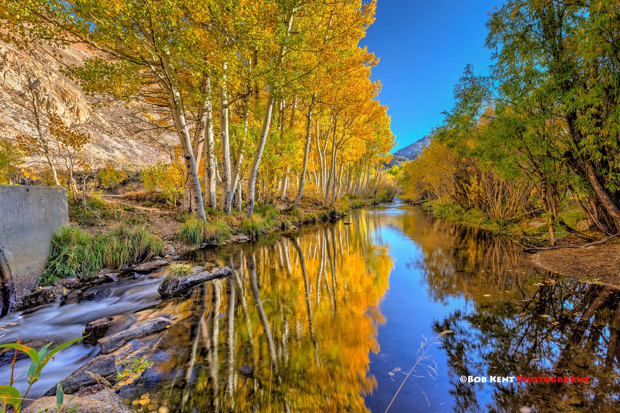
Weir Pond
Eastern Sierra Fall Colors Locations
While the Maine, Vermont, and the Rockies are better known for their fall colors there are plenty of places in the Eastern Sierra that put on quite a show. As the California Fall Color Web Site says “Dude, autumn happens here too.” Here are a some of the locations that usually have good showings:
- Big Pine Canyon
- Bishop Creek Canyon
- Lower Rock Creek
- Rock Creek Canyon
- McGee Creek
- Convict Lake
- June Lake Loop
- Sagehen Summit (Hwy 120)
- Lee Vining Canyon
- Lundy Canyon
- Virginia Lakes
- Conway Summit
- Walker River Canyon
- Lobdell Lake
- Monitor Pass
- Hope Valley
Viewing Etiquette
During the peak viewing time, there are tons of site-seers and photographers. Lately there are a lot of Photography Tour groups as well. There is enough beauty to go around to see so folks please be respectful of your fellow viewers! I remember a time where I was at North Lake very early in the morning. The sunrise was so beautiful and peaceful. That was until a large group of tourist that had broken up into two groups decided it was okay to loudly yell things to each other across the lake, ruining the peace for all others. Think before you yell, walk in front of someone’s camera scene, or bogart a location while other photographers are waiting behind you.
McGee Creek
Incredibly Helpful Resources for Planning Your Trip
Generally, the colors start changing first at higher altitudes usually in late September and the 1st week in October is best overall for color viewing. Unfortunately, it is not that simple. The change in fall colors is a very fickle thing. It does not always start on time. One location might look gorgeous one day then after a sudden wind storm, cold freeze, or snow storm be totally decimated the next day.
Fortunately, there are a lot of kind people that actively track and publish the current conditions. Some of the best sites are:
- California Fall Color
- California Fall Color Map
- Parchers Bishop Creek great for the Bishop Creek Canyon; North Lake, South Lake, Aspendell, and Lake Sabrina.
- Mono County Fall Color
- Calphoto Yahoo Group need to join.
- Sierra Fall Colors
- Natural History Wanderings Foliage Reports
Lower Rock Creek
Best blog post and How To Book
G. Dan Mitchell provide an incredible amount of valuable info!
· Sierra Nevada Fall Color Season – Coming Sooner Than You Think!
Hope this helps you in your quest to see one of nature’s best shows. Maybe I will see you out there among the colors!
Unbelievable - Time again for Fall Colors
Tips for your hunt for Fall Colors in the Eastern Sierra
Side Road on the way to South Lake
The forecast for the inland valleys in Southern California this past weekend is for 105! With that in mind it seems unbelievable that already Fall Colors season in the Eastern Sierra. Some web sites are already locations like Sabrina Campground and Rock Creek are at their peak!
For those looking to go to the Sierra to view the Fall Colors here are a list of links that will help you plan your hunt. I need to give credit to Sandy Steinman and her blog for the list of resources!
Be Sure To Look Down When Photographing Fall Colors
Places to See Fall Colors
South of Mammoth
- Hwy. 168 through Bishop Creek Canyon, Aspendell, Lake Sabrina, North Lake, and South Lake - Awesome canyon and creek side shots everywhere. Colors will peak at different altitudes at different times. - Along the road
- Convict Lake - Along the road
- McGee Canyon - Short hike
- Rock Creek - Along the road and moderate hike
North of Mammoth
- June Lakes Loop - Along the road
- Lundy Lake - Along the road and hike
- Parker Lake - Moderate Hike
- Conway Summit - Along freeway
- Dunderberg Road - Along the road dirt graded road
Resources for Determining Where the Color Is
Fall Colors are very finicky and can change in an instant. One wind or snow storm can change a location dramatically in less than a day. To see the best colors you have to be flexible and have up to date information. Luckily, there are dedicated Fall Color fans who track and post information on a regular basis. Here are some of the better sources of information:
- Natural History Wanderings Foliage Reports fall color reports posted on Natural History Wanderings
- Parchers Bishop Creek best foliage report for the Bishop Creek Canyon area in the Eastern Sierra.
- California Fall Color covers California fall color.
- California Fall Color Map interactive fall color map by California Fall Color blog
- Mono County Fall Color reports
- Calphoto Yahoo Group members post reports; must join to use.
- Sierra Fall Colors Sacramento Bee map rating fall color at many Sierra Nevada locations. updated on Thursdays.
Get Off the Beaten Path and Away From the Crowds!
Photographing Fall Colors
For the first several years I struggled to get images of fall colors that I liked. So I did my homework and my images improved. Here are links to some great photographic tips to get the best image of your fall color images. I especially like Steve Siren's recommendations
- Tips for Photographing Fall Color by Photo Naturalist (list of articles on photographing fall color)
- Top Ten Tips For Photographing Fall Color by Photo Cascadia
- Fall Color Photo Tips by Steve Siren
- Classic Fall Color: Capturing the best of autumn takes a combination of skill, preparation, timing and equipment by Stan Trzoniec from the Outdoor Photographerblog
- Top 5 Photo Tips for Autumn by Ian Plant from the Outdoor Photographer blog
Good luck on your adventures hunting the this year's Fall Colors. Just a reminder during the fall season there are a lot of folks, photographers and non-photographers, enjoying the spectacular fall colors. Be mindful you are not alone and show courtesy for others.
If you see someone setting up for an image up the road from you give them some time to capture their image.
If you are at an iconic spot where lot's of people want to take a photograph. Take yours and move on so others can too.
The Sierra are huge and there are plenty of beautiful scenes and plenty of room for everyone.
Another Bucket List Checked Off – Getting to a Sierra Pass
Hiking Mono Pass Yosemite is a great hike full of wonderful views of granite peaks and alpine meadows. It has a hidden gift in being able to see Mono Lake 4,000 feet below you!
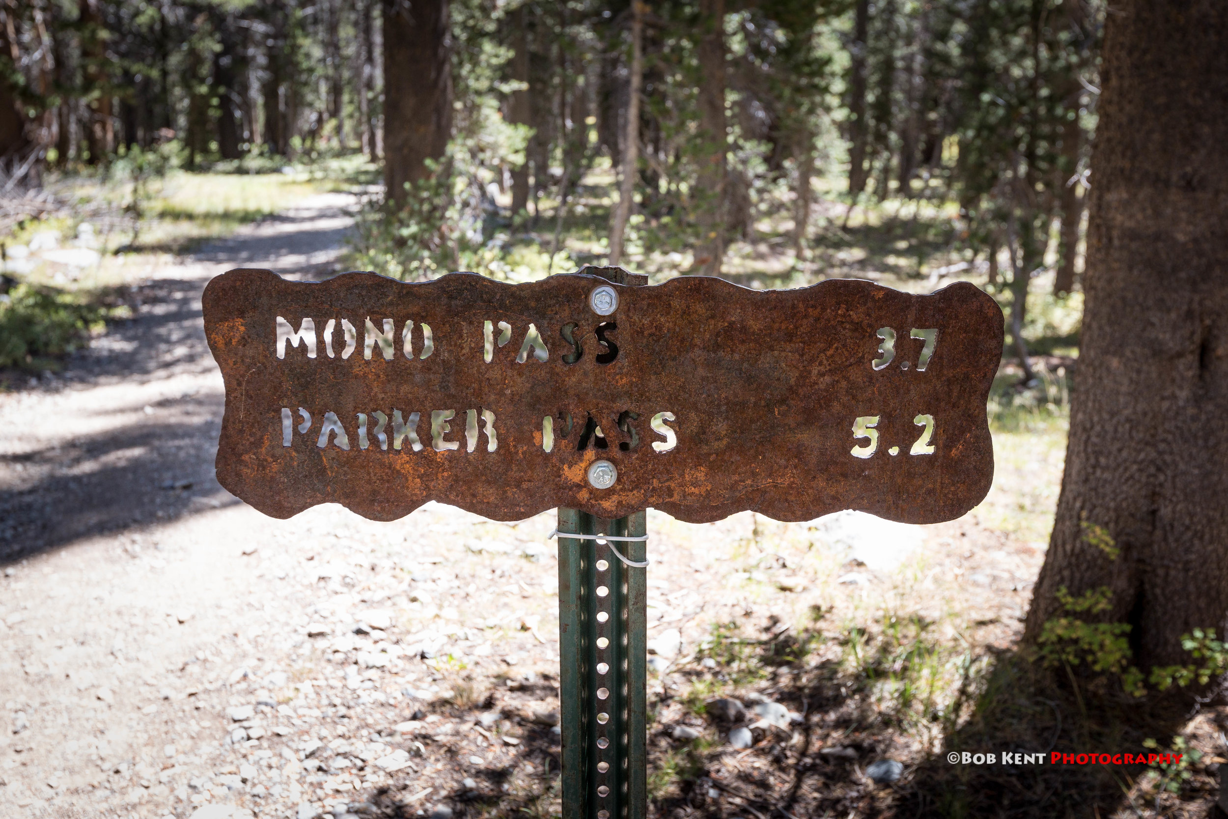
Trail Head
-
March 2026
- Mar 24, 2026 The Impact of AI on Photography Mar 24, 2026
-
October 2024
- Oct 20, 2024 Three Days of Fall Colors in the Eastern Sierra Oct 20, 2024
-
May 2023
- May 18, 2023 Cloudy with a 100% of Spectacular May 18, 2023
-
December 2022
- Dec 30, 2022 20 Yards of Track Dec 30, 2022
-
July 2022
- Jul 9, 2022 Channeling Huell Howser in the Eastern Sierra Jul 9, 2022
-
June 2022
- Jun 24, 2022 Quiet Moment - Waterfall Jun 24, 2022
-
May 2022
- May 1, 2022 Cloud's Life Lessons May 1, 2022
-
January 2022
- Jan 17, 2022 Best Images 0f 2021 Jan 17, 2022
-
December 2021
- Dec 12, 2021 Owens Valley: The Tule Elk on Hwy 395 Dec 12, 2021
-
November 2021
- Nov 5, 2021 Five Reasons to Buy a Wall Calendar Nov 5, 2021
-
October 2021
- Oct 25, 2021 Eastern Sierra Intimate Fall Colors Oct 25, 2021
-
July 2021
- Jul 19, 2021 Clouds make my Eastern Sierra Sunset Images Pop! Jul 19, 2021
- Jul 12, 2021 Sound of Silence Jul 12, 2021
-
June 2021
- Jun 7, 2021 Sunrise, Sunset Jun 7, 2021
-
May 2021
- May 17, 2021 Early Morning Around the Loop May 17, 2021
- May 3, 2021 The Case for Lingering May 3, 2021
-
January 2020
- Jan 31, 2020 Best Images of 2019 Jan 31, 2020
-
July 2019
- Jul 1, 2019 A Different Take on Bodie Jul 1, 2019
-
June 2019
- Jun 10, 2019 Heaven Jun 10, 2019
-
May 2019
- May 20, 2019 A Perfectly Cloudy Day May 20, 2019
-
April 2019
- Apr 1, 2019 My Path to Better Wildflower Images Apr 1, 2019
-
March 2019
- Mar 25, 2019 March in Like a Lion ( and leave the same way!) Mar 25, 2019
- Mar 15, 2019 The End of the Line (well maybe) - Keeler Mar 15, 2019
-
February 2019
- Feb 26, 2019 Lone Pine the Little Town Below a Big Mountain Feb 26, 2019
- Feb 18, 2019 The Word of the Month for February - Snow Feb 18, 2019
- Feb 11, 2019 The Wildflowers are Coming, the Wildflowers are Coming; are You Prepared? Feb 11, 2019
- Feb 4, 2019 Nature’s Vastness is Good for Our Souls Feb 4, 2019
-
January 2019
- Jan 20, 2019 Hike Big Sycamore Canyon - Tejon Ranch Jan 20, 2019
- Jan 13, 2019 Clouds and Glass Jan 13, 2019
- Jan 5, 2019 My 12 Best Images of 2018 Jan 5, 2019
-
September 2017
- Sep 22, 2017 Dad Why Do the Trees Change Colors? Sep 22, 2017
- Sep 11, 2017 Eastern Sierra Early Morning Scramble (ESMS) Sep 11, 2017
-
August 2017
- Aug 14, 2017 Another Hidden Gem Along Highway 395 Aug 14, 2017
-
July 2017
- Jul 31, 2017 FIVE SIMPLE STEPS TO ENJOY YOSEMITE ON A CROWDED WEEKEND Jul 31, 2017
- Jul 24, 2017 Mom, why is the sky blue? Mom, Why is the sunset red? Mom, why does it always looks better in the Eastern Sierra? Answers to questions you May have always wanted to know Jul 24, 2017
- Jul 10, 2017 The Streams are Alive Jul 10, 2017
-
June 2017
- Jun 27, 2017 Water Everywhere! Jun 27, 2017
-
January 2017
- Jan 23, 2017 Cannot Fight It Might as Well Join It Jan 23, 2017
- Jan 16, 2017 Clouds are the Photographers Spice of Life Jan 16, 2017
- Jan 10, 2017 Sunrise to Sunset in Southern California Jan 10, 2017
- Jan 2, 2017 My Top Images of 2016 Jan 2, 2017
-
December 2016
- Dec 29, 2016 Operation Santa Status - A Success Dec 29, 2016
- Dec 21, 2016 Time to Celebrate it is the Shortest, Darkest Damn Day of the Year Dec 21, 2016
- Dec 19, 2016 The Joy of Christmas Trees Dec 19, 2016
- Dec 14, 2016 Don Henley was Wrong You can go Back Dec 14, 2016
- Dec 7, 2016 Update on Operation Santa Dec 7, 2016
- Dec 5, 2016 Quests in the Owens Valley are Fun Dec 5, 2016
-
November 2016
- Nov 28, 2016 Santa’s Letters a Way to Make a Difference Nov 28, 2016
- Nov 21, 2016 Awesome Austin Nov 21, 2016
- Nov 7, 2016 Veteran's Day Nov 7, 2016
-
October 2016
- Oct 31, 2016 Dia de los Muertos 2016 Oct 31, 2016
- Oct 24, 2016 Of Frequency and Luck Oct 24, 2016
- Oct 17, 2016 Show ‘Em That Flat Penny Oct 17, 2016
- Oct 10, 2016 Fall Colors in the Sierra Oct 10, 2016
- Oct 3, 2016 What a Summer! Looking Back as We Move To Fall Oct 3, 2016
-
September 2016
- Sep 26, 2016 Tom's Place Sep 26, 2016
- Sep 19, 2016 Unbelievable - Time again for Fall Colors Sep 19, 2016
- Sep 10, 2016 Another Bucket List Checked Off – Getting to a Sierra Pass Sep 10, 2016
-
January 2016
- Jan 23, 2016 Lake Havasu Balloon Festival Jan 23, 2016
-
November 2015
- Nov 5, 2015 2016 Calendars Nov 5, 2015
-
July 2015
- Jul 11, 2015 See Less Enjoy More Jul 11, 2015
-
May 2015
- May 22, 2015 Some Things Age With Grace May 22, 2015
- May 15, 2015 Welcome to the Website Launch May 15, 2015
Working to complete my 54 for Dave Quest I have done more hikes this summer than ever before. I came to realize though I had yet to hike to a mountain pass, ever. I had come close. Once on the McGee Creek trail but was stopped by snow. Another time on the Crystal Lake hike but was going to Crystal Lake not the pass. So I had never actually stood on top of a Sierra mountain pass. It became a bucket list item! So I started looking for a day hike that got me to a pass.
Mono Pass in Yosemite seemed to fit the bill. It was in the Yosemite high country in which I love hiking in. It had a reasonable difficulty level at eight miles in length (round trip) and 900 feet of altitude gain it figured it would be pleasant hike.
The description of the hike on the Yosemite Hikes web page seemed to good to be true to get to a pass. “There are only a few stretches where the incline is steep enough to make you notice you're climbing.” Well it was to good to be true as one of those “stretches” was as over a mile and had a pretty steep grade.
Even with the unexpected climb I really enjoyed this hike. While it did not have a big lake at the end like some hikes do; the high country meadows and the view down Bloody Canyon to Mono Lake more than made up for it.
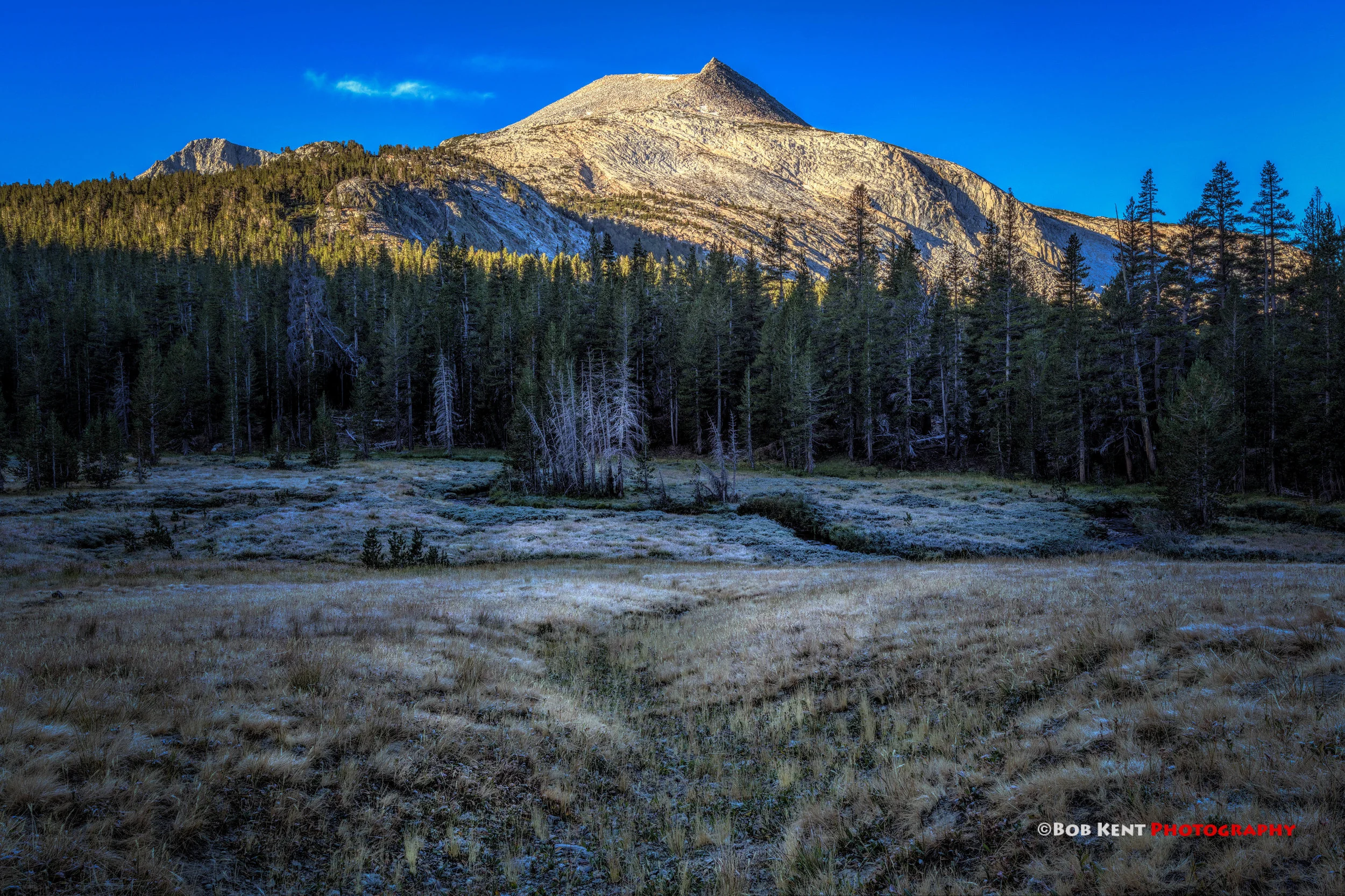
Mono Pass is the type of hike I like because it starts of flat and saves the climb later on once your warmed up. My start time at 6:30 AM was perfect to catch the first morning light on Mammoth Peak
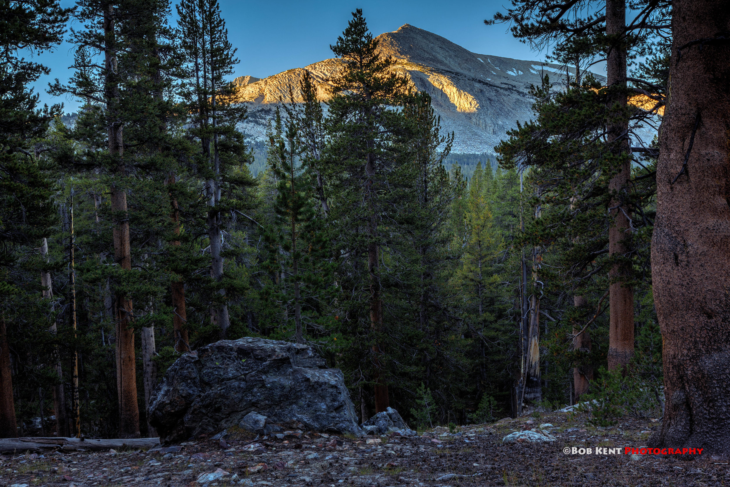
First Light on Mammoth Peak

Mammoth Peak Overlooking a Meadow
eing late in the summer most of the creeks were dry. That is good and bad. Bad, because I imagine the streams were knock down gorgeous. Good, because I did not encounter one mosquito on the entire hike. Dana Fork was the primary exception to this water drought and provided a beautiful log water fall right next to the trail.

Dana Fork Waterfall
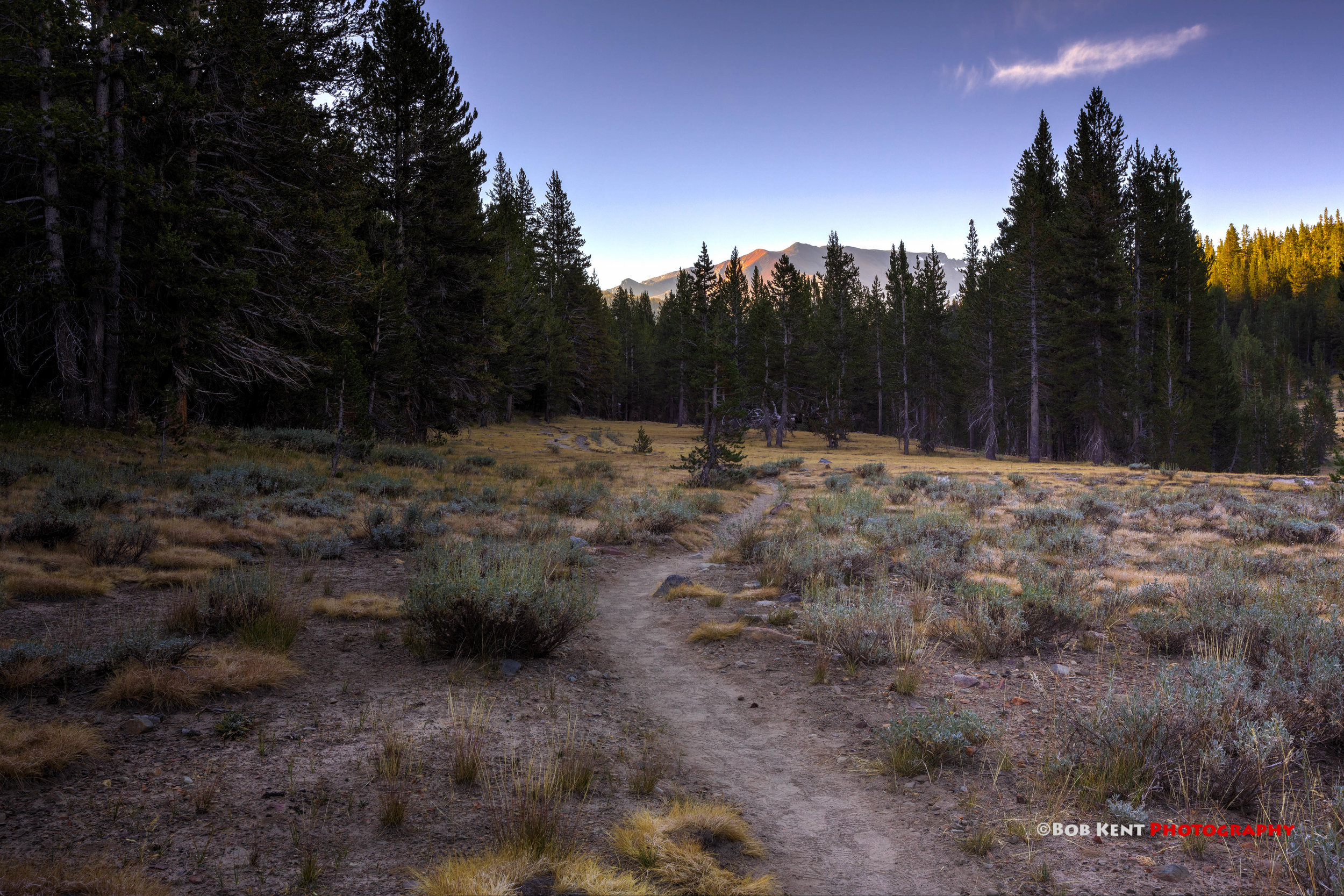
Looking Up the Trail in the Morning Light
There are a couple of decaying mining cabins along the trail. A bit of background on these cabins. The Homer Mining Index, one of the few papers in the area at the time, states that Fuller and Hayt (or Hoyt) discovered antimonial silver in Mono Pass and called their claim the Golden Crown. The Mammoth City Herald, another newspaper of the day predicted that within a year, thousands of miners would be working in Mono Pass at the Golden Crown. The mines never panned out and Mono Pass will be remembered as a way for miners to cross the Sierra to get to Dogtown and Monoville, mines on the eastern Sierra near Mono Lake. The cabins are a quite reminder of the mining history of the area.

First Cabin

Cabin II
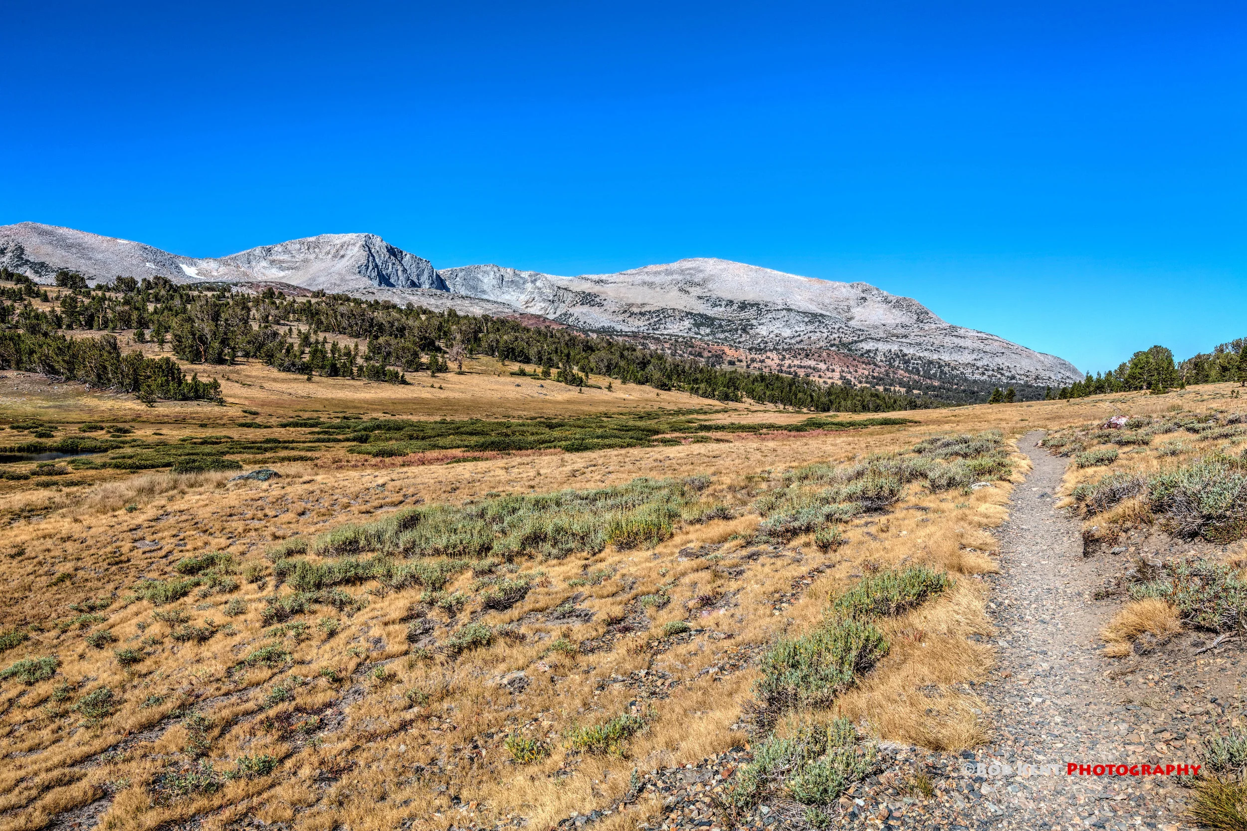
There is long section that climbs up. After that ordeal you are rewarded as the trail weaves in and out of a stunningly beautiful alpine meadow. There are also beautiful views of Mt Lewis and the Kuna Crest.

Looking Forward to Mt Lewis
Looking Back to the Kuna Crest
Just before the pass is a lovely unnamed pond. A short distance farther up the trail, at the summit, is a small lake appropriately named Summit Lake. This is the end of the Mono Pass trail and the beginning of the Bloody Canyon trail. It is also the edge of Yosemite Park. Up to this point the Mono Pass trail was beautiful forest and meadows. In contrast, Bloody Canyon is barren rock. An incredible difference and a testimonial to the impact the Sierra has on the weather and the land around it.
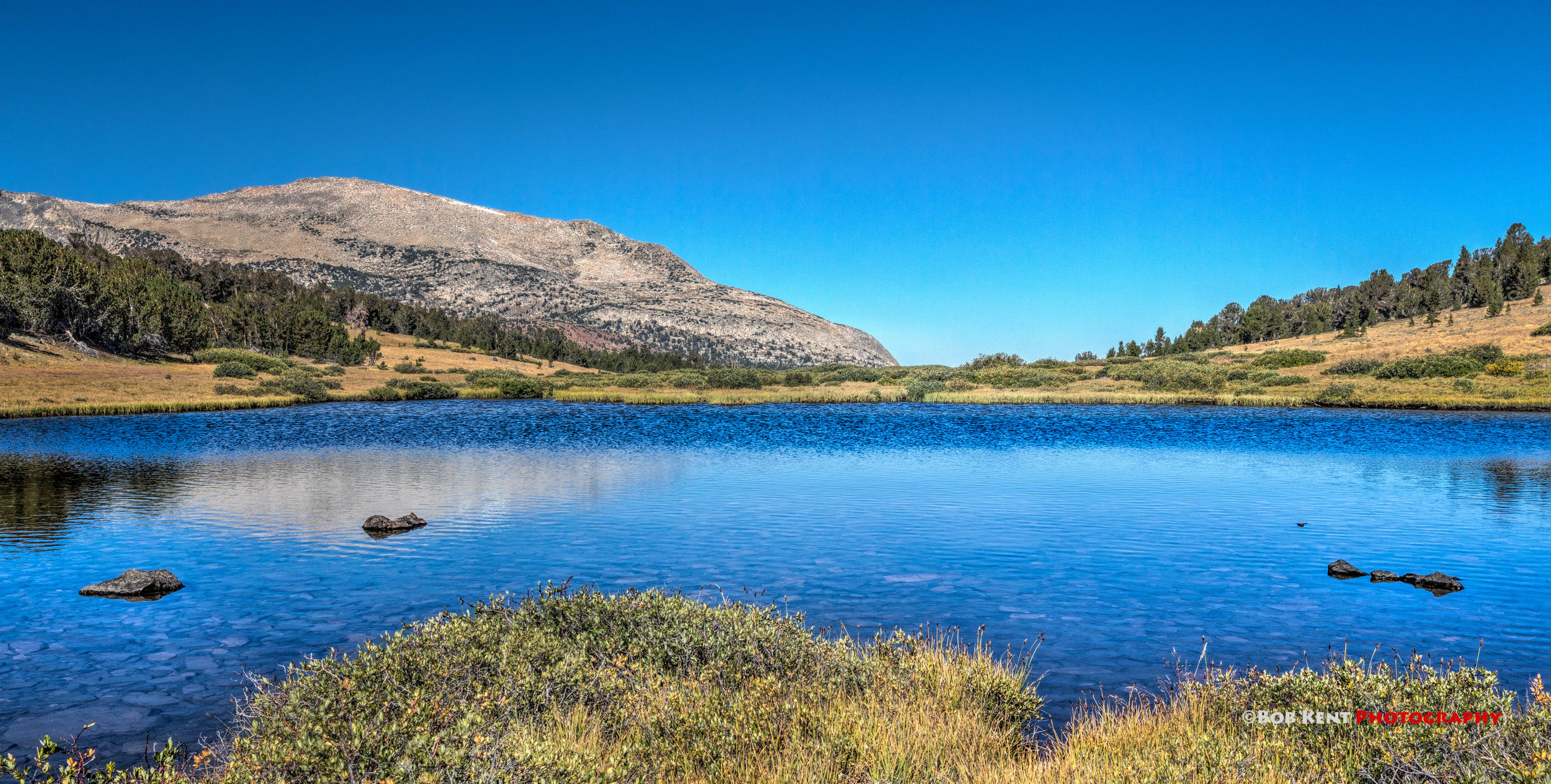
Unnamed Pond
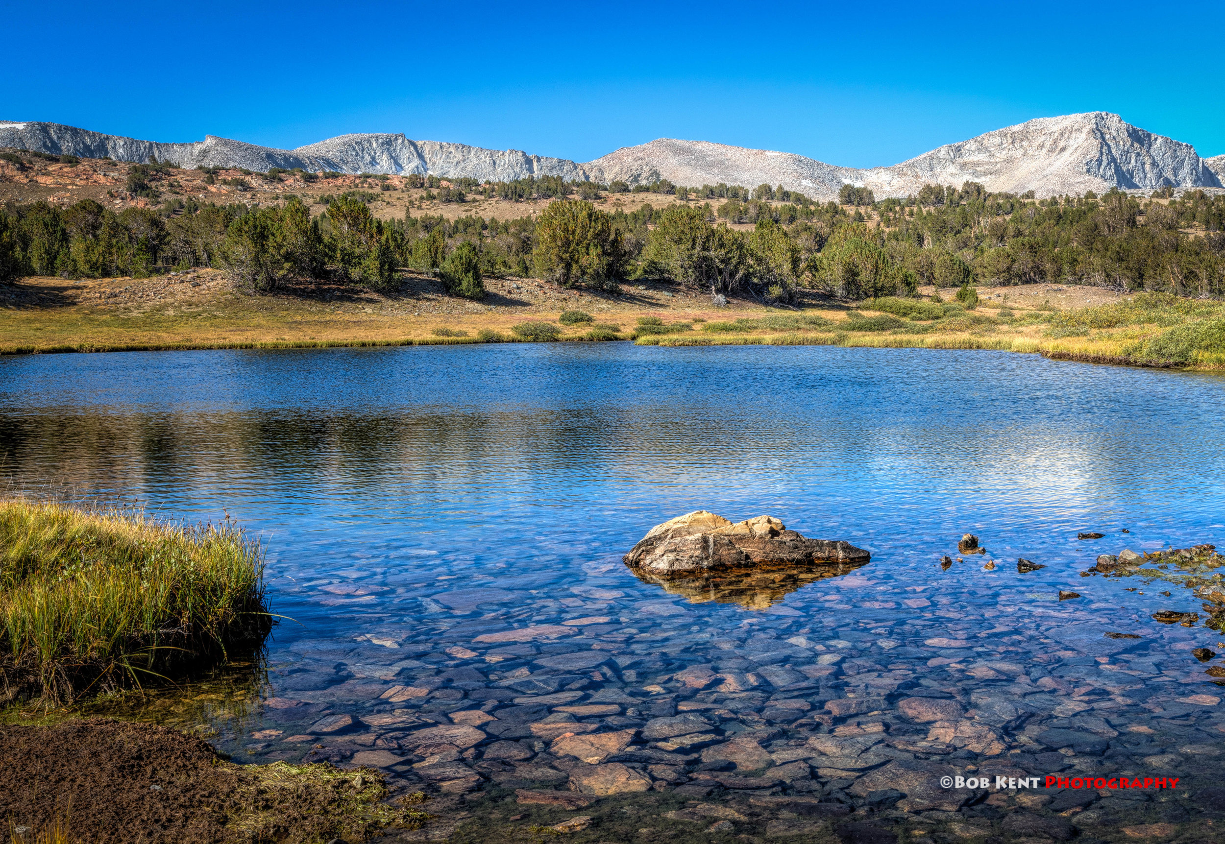
Unnamed Pond

Other Places to Go!
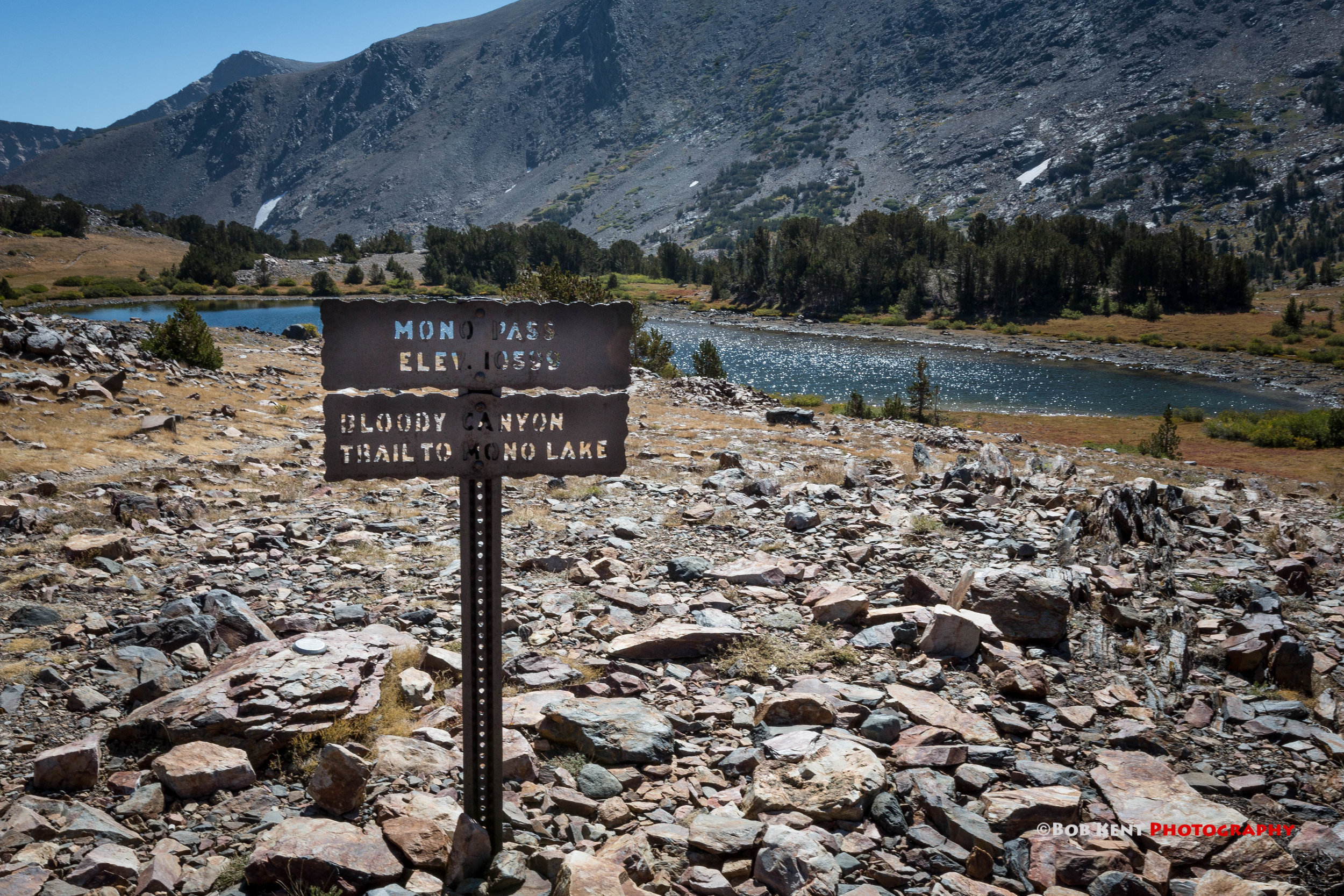
Mono Pass and Summit Lake
I continued for a for just over a quarter of a mile down the Bloody Canyon trail toward Upper Sardine Lake to get a scenic look of Mono Lake 4,000 feet below. The view is awesome and one of the reasons I did this hike!

Bloody Canyon with Mono Lake Below
This was a wonderful hike with great views of the Yosemite high country, granite peaks like Mammoth and Mt. Lewis, and Mono Lake. I will definitely do it again and maybe finish at Spillway Lake.